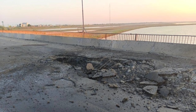
The Dnipro Osint Telegram channel stated this, citing satellite imagery. “Satellite images have recorded the aftermath of new attacks in Crimea. As of September 26, at least three large holes were visible in the roadway of the bridge and the adjacent crossing. This significantly complicated traffic and caused a backlog of logistical transport, including military vehicles,” the report said. It is noted that an image dated September 30 already shows that a span of the bridge had collapsed. The Chonhar road bridge is one of the key land crossings between the Kherson region and Crimea. It is an important logistical artery that has repeatedly been attacked by the Ukrainian Defense Forces.
Головну думку ми показуємо публічно. Створіть безкоштовний акаунт, щоб читати повну статтю, зберігати її, обговорювати та поєднувати з ринковим і OSINT-контекстом.